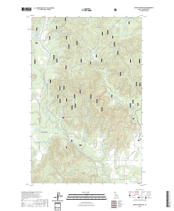
2024 Map of Quartz Mountain
USGS Topo · Published 2024About this map
Four Corners serves as a small waypoint in this high-elevation landscape within Bonner County, where the topography is defined by the drainage basins of the West Fork and East Fork Moores Creeks. These headwaters flow through steep forested terrain, eventually joining and flowing north toward more developed valleys. The network of forest roads and creek basins recorded here by the U.S. Geological Survey provides a precise view of the drainage patterns and access routes in this part of the Idaho Panhandle. Historically significant for its watershed and timber management, the area around Murray Creek remains largely undeveloped, preserving the original hydrographic features and natural contours of the region as they were documented in the early 21st century.
Find a feature on this map
4 named features on this map. Tap any name to fly to it.
Don’t see what you’re looking for? This feature index may not catch every label — zoom into the map to look around manually.
Map Details
Editions of this 2024 Quartz Mountain Map
This is the sole edition of this map. No revisions or reprints were ever made.
Other maps of this area

1901 · Sandpoint
USGS Topo · 1:125,000

1911 · Priest Lake
USGS Topo · 1:250,000

1911 · Sandpoint
USGS Topo · 1:125,000

1913 · Priest Lake
USGS Topo · 1:250,000

1936 · Newport
USGS Topo · 1:96,000

1942 · Newport
USGS Topo · 1:125,000

1958 · Sandpoint
USGS Topo · 1:250,000

1963 · Sandpoint
USGS Topo · 1:250,000

1967 · Quartz Mtn
USGS Topo · 1:24,000

1967 · Coolin
USGS Topo · 1:24,000