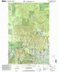
1996 Map of Quartz Mountain
USGS Topo · Published 1999About this map
Quartz Mountain anchors this northern Idaho landscape, which was revised in the mid-1990s to reflect the evolving topography of the Kaniksu National Forest. The map details a rugged drainage network defined by the West Branch Priest River and its numerous tributaries, including Kavanaugh Creek and Quartz Creek. Human presence is concentrated along corridors like West Shore Road, leading toward the junction at Four Corners. Small-scale industrial activity is evidenced by several Gravel Pit locations, while natural clearings such as Daggett Meadow and Snow Valley interrupt the dense forest cover. The mapping of the First Standard Parallel North provides a critical geodetic reference point for researchers tracing forest boundaries and historic land use patterns in Bonner County.
Find a feature on this map
21 named features on this map. Tap any name to fly to it.
Don’t see what you’re looking for? This feature index may not catch every label — zoom into the map to look around manually.
Map Details
Editions of this 1996 Quartz Mountain Map
This is the sole edition of this map. No revisions or reprints were ever made.
Other maps of this area

1901 · Sandpoint
USGS Topo · 1:125,000

1911 · Priest Lake
USGS Topo · 1:250,000

1911 · Sandpoint
USGS Topo · 1:125,000

1913 · Priest Lake
USGS Topo · 1:250,000

1936 · Newport
USGS Topo · 1:96,000

1942 · Newport
USGS Topo · 1:125,000

1958 · Sandpoint
USGS Topo · 1:250,000

1963 · Sandpoint
USGS Topo · 1:250,000

1967 · Quartz Mtn
USGS Topo · 1:24,000

1967 · Coolin
USGS Topo · 1:24,000