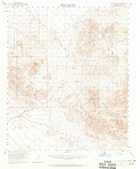
1953 Map of Quartz Peak
USGS Topo · Published 1971About this map
The Chocolate Mountains dominate this 1953 landscape, a desert region defined by its reliance on scarce water sources and its mining history. Remote outposts like Imperial Gables and Midway Well provide some of the few named human markers in an area characterized by dry washes such as Vinagre Wash and Gables Wash. Mining activity is evident throughout the southern and central sections, including the Paymaster Mine, Rainbow Mine, and the Gold Basin Rand Mine.
Find a feature on this map
25 named features on this map. Tap any name to fly to it.
Don’t see what you’re looking for? This feature index may not catch every label — zoom into the map to look around manually.
Map Details
Editions of this 1953 Quartz Peak Map
4 editions found

Other maps of this area

1903 · Yuma
USGS Topo · 1:125,000

1905 · Yuma
USGS Topo · 1:125,000

1907 · Holtville
USGS Topo · 1:125,000

1942 · El Centro
USGS Topo · 1:250,000

1942 · Yuma
USGS Topo · 1:250,000

1942 · Blythe
USGS Topo · 1:250,000

1945 · Picacho Peak
USGS Topo · 1:62,500

1945 · Cibola
USGS Topo · 1:62,500

1945 · Picacho
USGS Topo · 1:62,500

1951 · Picacho
USGS Topo · 1:62,500