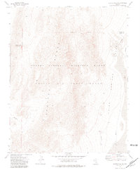
1973 Map of Quartz Peak SW
USGS Topo · Published 1981About this map
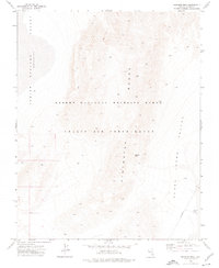
Spotted Range peaks and desert basins dominate this 1970s landscape, reflecting the dual management of southern Nevada’s interior by military and conservation agencies. The terrain is split between the Nellis Air Force Range, a massive restricted testing area, and the Desert National Wildlife Range, which preserves the habitat of the region's diverse flora and fauna. To the east, the broad expanse of the Indian Springs Valley provides a striking contrast to the high, ridged topography. Geopolitical markers include the Lincoln Co Clark Co line and an Indefinite Boundary running through the northern sector, indicating the complexities of surveying this arid, high-elevation environment before modern GPS refinement.
Find a feature on this map
6 named features on this map. Tap any name to fly to it.
Don’t see what you’re looking for? This feature index may not catch every label — zoom into the map to look around manually.
Map Details
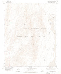
Editions of this 1973 Quartz Peak SW Map
2 editions found
Other maps of this area

1907 · Las Vegas
USGS Topo · 1:250,000

1908 · Las Vegas
USGS Topo · 1:250,000

1942 · Indian Spring
USGS Topo · 1:125,000
1952 · Mercury
USGS Topo · 1:62,500
1952 · Frenchman Lake
USGS Topo · 1:62,500

1954 · Las Vegas
USGS Topo · 1:250,000

1957 · Las Vegas
USGS Topo · 1:250,000

1959 · Las Vegas
USGS Topo · 1:250,000

1962 · Las Vegas
USGS Topo · 1:250,000
1973 · Heavens Well
USGS Topo · 1:24,000