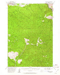
1956 Map of Quartzville
USGS Topo · Published 1961About this map
Mill City and the North Santiam River define the northern corridor of this mid-century survey, while the southern reaches reveal the deep mining and timber legacy of the Cascades. The map captures a moment of significant infrastructure development, showing the Detroit Dam and the Detroit Res alongside numerous mountain lookouts and guard stations. Mining history is preserved at the Quartzville settlement and the Albany Mine, located near Dry Gulch.
Find a feature on this map
58 named features on this map. Tap any name to fly to it.
Don’t see what you’re looking for? This feature index may not catch every label — zoom into the map to look around manually.
Map Details
Editions of this 1956 Quartzville Map
3 editions found

Other maps of this area

1929 · Mill City
USGS Topo · 1:125,000

1934 · Mc Kenzie Bridge
USGS Topo · 1:96,000

1940 · Mc Kenzie Bridge
USGS Topo · 1:125,000

1951 · Sweet Home
USGS Topo · 1:62,500

1951 · Lyons
USGS Topo · 1:62,500

1951 · Snow Peak
USGS Topo · 1:62,500

1953 · Salem
USGS Topo · 1:250,000

1954 · Salem
USGS Topo · 1:250,000

1955 · Cascadia
USGS Topo · 1:62,500

1955 · Echo Mountain
USGS Topo · 1:62,500