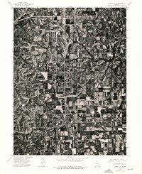
1974 Map of Queen City NE
USGS Topo · Published 1976About this map
Queen City serves as the focal point of this 1974 orthophotographic study in Schuyler County, Missouri. Unlike traditional topographic maps, this imagery-based survey provides a direct view of the land use patterns during the mid-1970s, revealing the dense grid of the settlement and its transition into the surrounding agricultural patchwork. The high-altitude aerial photography captured by the U.S. Geological Survey on April 15, 1974, clearly delineates the patchwork of woodlots and drainage patterns that define the local terrain. For those researching the history of northern Missouri, this document preserves the exact physical footprint of the landscape and the road network as it appeared several decades ago, offering a detailed perspective on rural development and land management in the region.
Find a feature on this map
1 named feature on this map. Tap any name to fly to it.
Don’t see what you’re looking for? This feature index may not catch every label — zoom into the map to look around manually.
Map Details
Editions of this 1974 Queen City NE Map
This is the sole edition of this map. No revisions or reprints were ever made.
Other maps of this area

1903 · Edina
USGS Topo · 1:125,000

1911 · Queen City
USGS Topo · 1:62,500

1913 · Queen City
USGS Topo · 1:62,500

1954 · Centerville
USGS Topo · 1:250,000

1957 · Centerville
USGS Topo · 1:250,000

1958 · Centerville
USGS Topo · 1:250,000

1965 · Downing NW
USGS Topo · 1:24,000
1966 · Willmathsville
USGS Topo · 1:24,000
1974 · Queen City NW
USGS Topo · 1:24,000
1974 · Queen City SE
USGS Topo · 1:24,000