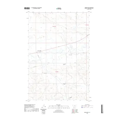
2020 Map of Queens Point
USGS Topo · Published 2020About this map
The Musselshell River meanders across this Musselshell County landscape, defining the local geography through a series of pronounced bends and the creation of prominent coulees. To the north, the terrain is shaped by the eponymous Queens Point, while the agricultural irrigation network is evidenced by the Chandler Ditch. This 2020 edition documents a rural region where land management is segmented by historical township and range lines, such as t9n r30e and t10n r30e. Drainage patterns are clearly marked by named seasonal features like Finnan Coulee, Cunningham Coulee, and Burnt Shed Coulee. These labels, along with watercourses like Carpenter Cr and its E Fork Carpenter Cr, provide essential reference points for understanding the hydrologic and topographic layout of the area south of N Melstone Rd and Railway Ave.
Find a feature on this map
22 named features on this map. Tap any name to fly to it.
Don’t see what you’re looking for? This feature index may not catch every label — zoom into the map to look around manually.
Map Details
Editions of this 2020 Queens Point Map
This is the sole edition of this map. No revisions or reprints were ever made.
Other maps of this area

1954 · Forsyth
USGS Topo · 1:250,000

1954 · Roundup
USGS Topo · 1:250,000

1957 · Forsyth
USGS Topo · 1:250,000

1958 · Roundup
USGS Topo · 1:250,000

1958 · Forsyth
USGS Topo · 1:250,000

1962 · Queens Point
USGS Topo · 1:24,000

1962 · Melstone NE
USGS Topo · 1:24,000

1962 · Melstone NW
USGS Topo · 1:24,000

1963 · Melstone
USGS Topo · 1:24,000

1963 · Musselshell
USGS Topo · 1:24,000