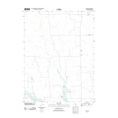
2011 Map of Quick
USGS Topo · Published 2011About this map
Quick sits at the intersection of rural thoroughfares in Frontier County, marking a centered point within a landscape defined by the agricultural grid and the hydrological system of the Republican River basin. To the south, the expansive waters of Hugh Butler Lake dominate the terrain, created by the impoundment of Red Willow Creek. This reservoir area provides a focal point for recreation, evidenced by the clustered Bluegill Haven Campground, Bobwhite Campground, and Pikes Point Campground. Further north, smaller water management features like Kaler Reservoir and Teel Reservoir Number 2 dot the drainage of Spring Creek, illustrating the region's reliance on managed water resources for its upland prairie environment. Local history is anchored by the Garden Prairie Cemetery, a significant site for genealogical research located just north of the settlement of Quick.
Find a feature on this map
13 named features on this map. Tap any name to fly to it.
Don’t see what you’re looking for? This feature index may not catch every label — zoom into the map to look around manually.
Map Details
Editions of this 2011 Quick Map
This is the sole edition of this map. No revisions or reprints were ever made.
Other maps of this area

1954 · McCook
USGS Topo · 1:250,000

1956 · Curtis SW
USGS Topo · 1:24,000

1956 · Quick NE
USGS Topo · 1:24,000

1956 · Curtis SE
USGS Topo · 1:24,000

1957 · McCook
USGS Topo · 1:250,000

1958 · McCook
USGS Topo · 1:250,000

1970 · Red Willow Dam
USGS Topo · 1:24,000

1970 · Quick
USGS Topo · 1:24,000

1970 · Burger Canyon SE
USGS Topo · 1:24,000

1970 · Quick SE
USGS Topo · 1:24,000