
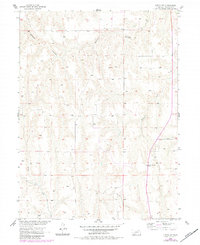
1956 Map of Curtis SW
USGS Topo · Published 1957About this map
Deeply incised drainage patterns characterize this 1950s survey of Frontier County, Nebraska. The landscape is defined by the branching tributaries of Elkhorn Canyon in the north and the winding course of Spring Creek in the southwest. Between these watercourses, the terrain is partitioned into named districts including Laird, Weaver, Zimmer, and Lincoln, reflecting the localized organizational divisions of the era. Settlement is sparse, focused around individual rural farmsteads and the Prairie Bell Sch, which serves as a central landmark for this agricultural community. The map provides a detailed view of the area's geography as part of the Missouri River Basin development program, illustrating the complex relationship between the prairie plateau and the eroding canyons that cut through it.
Find a feature on this map
9 named features on this map. Tap any name to fly to it.
Don’t see what you’re looking for? This feature index may not catch every label — zoom into the map to look around manually.
Map Details
Editions of this 1956 Curtis SW Map
2 editions found
Other maps of this area

1954 · McCook
USGS Topo · 1:250,000

1956 · White NE
USGS Topo · 1:24,000

1956 · Curtis NW
USGS Topo · 1:24,000

1956 · Quick NE
USGS Topo · 1:24,000

1956 · Curtis
USGS Topo · 1:24,000

1956 · Curtis SE
USGS Topo · 1:24,000

1957 · McCook
USGS Topo · 1:250,000

1958 · McCook
USGS Topo · 1:250,000

1970 · Quick
USGS Topo · 1:24,000

1970 · Burger Canyon East
USGS Topo · 1:24,000