
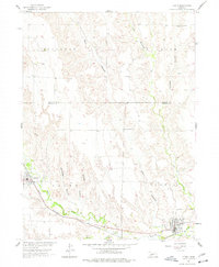
1956 Map of Curtis
USGS Topo · Published 1957About this map
Medicine Creek and its many winding tributaries define the topography of this Frontier County landscape during the mid-1950s. The settlement of Curtis serves as a local hub in the southeast, situated where Curtis Creek meets the larger valley. The Chicago Burlington and Quincy railroad tracks parallel the creek bed, providing a vital transportation link for the rural communities of Maywood and Curtis.
Find a feature on this map
20 named features on this map. Tap any name to fly to it.
Don’t see what you’re looking for? This feature index may not catch every label — zoom into the map to look around manually.
Map Details
Editions of this 1956 Curtis Map
2 editions found
Other maps of this area

1902 · Gothenburg
USGS Topo · 1:125,000

1954 · McCook
USGS Topo · 1:250,000

1956 · Jeffrey Reservoir SW
USGS Topo · 1:24,000

1956 · Curtis SW
USGS Topo · 1:24,000

1956 · Moorefield
USGS Topo · 1:24,000

1956 · Curtis NW
USGS Topo · 1:24,000

1956 · Curtis SE
USGS Topo · 1:24,000

1956 · Stockville
USGS Topo · 1:24,000

1956 · Wellfleet SE
USGS Topo · 1:24,000

1956 · Wellfleet
USGS Topo · 1:24,000