
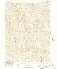
1956 Map of Jeffrey Reservoir SW
USGS Topo · Published 1957About this map
Jeffrey Queen Sch and Dempcy Sch serve as the primary landmarks in this mid-century view of southwestern Lincoln County, where the high plains are deeply dissected by a network of steep drainages. The landscape is defined by the sharp contrasts between plateau tops like Cottonwood and the numerous named ravines that channel water toward the south and east. Major systems such as Snell Canyon and Conroy Canyon give way to the winding courses of Fox Creek and Deer Creek, illustrating the complex erosion patterns characteristic of the Nebraska loess hills. The map highlights the sparse, rural infrastructure of the 1950s, focused around small schoolhouses and seasonal watercourses like East Fork Dry Creek and Dempcy Draw. This survey provides a precise record of the topography and land-use patterns before later shifts in agricultural technology and rural school consolidation changed the local geography.
Find a feature on this map
16 named features on this map. Tap any name to fly to it.
Don’t see what you’re looking for? This feature index may not catch every label — zoom into the map to look around manually.
Map Details
Editions of this 1956 Jeffrey Reservoir SW Map
2 editions found
Other maps of this area

1902 · Gothenburg
USGS Topo · 1:125,000

1954 · McCook
USGS Topo · 1:250,000

1956 · Stockville NE
USGS Topo · 1:24,000

1956 · Moorefield
USGS Topo · 1:24,000

1956 · Curtis
USGS Topo · 1:24,000

1956 · Wellfleet SE
USGS Topo · 1:24,000

1956 · Wellfleet NE
USGS Topo · 1:24,000

1957 · McCook
USGS Topo · 1:250,000

1958 · McCook
USGS Topo · 1:250,000
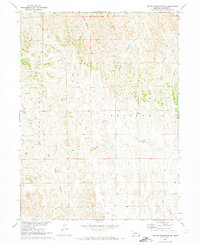
1970 · Jeffrey Reservoir SE
USGS Topo · 1:24,000