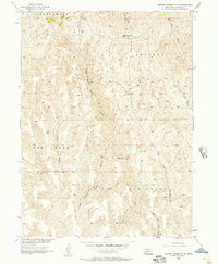
1956 Map of Jeffrey Reservoir SW
USGS Topo · Published 1957About this map
The dissected tablelands of Lincoln County, Nebraska, are captured here during the mid-1950s, a period of transition within the Missouri River Basin development program. The landscape is defined by an intricate network of drainage systems, including the headwaters of East Curtis Creek and the meandering path of Deer Creek. These waterways have carved deep relief into the terrain, creating a series of named landforms such as Snell Canyon and Jeffrey Canyon.
Find a feature on this map
17 named features on this map. Tap any name to fly to it.
Don’t see what you’re looking for? This feature index may not catch every label — zoom into the map to look around manually.
Map Details
Editions of this 1956 Jeffrey Reservoir SW Map
2 editions found
Other maps of this area

1902 · Gothenburg
USGS Topo · 1:125,000

1954 · McCook
USGS Topo · 1:250,000

1956 · Jeffrey Reservoir SW
USGS Topo · 1:24,000

1956 · Stockville NE
USGS Topo · 1:24,000

1956 · Moorefield
USGS Topo · 1:24,000

1956 · Curtis
USGS Topo · 1:24,000

1956 · Wellfleet SE
USGS Topo · 1:24,000

1956 · Wellfleet NE
USGS Topo · 1:24,000

1957 · McCook
USGS Topo · 1:250,000

1958 · McCook
USGS Topo · 1:250,000