
1956 Map of Stockville NE
USGS Topo · Published 1957About this map
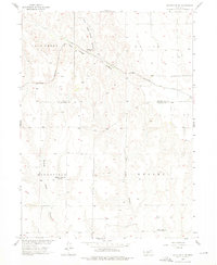
The dissected tablelands of the Lincoln Co Frontier Co boundary are defined by a complex network of canyons and creeks, including Deer Creek and the deep incision of East Deer Creek Canyon. This 1950s survey documents a rural landscape in transition, characterized by the shifting status of local education. While Ingham Sch remained active near the Chicago Burlington and Quincy railroad, other community hubs such as Mount Hope Sch and Mulberry Ridge Sch were already marked as abandoned. The iron rails of the Burlington route cut a diagonal path across the northern reaches of the quadrangle, serving as the primary infrastructure for this agricultural region. Evidence of early Catholic settlement is found at St Joseph Cem in the northeast, while a modern TV Relay Tower stands as a vertical landmark against the traditional canyon topography of Walker and Russell townships.
Find a feature on this map
16 named features on this map. Tap any name to fly to it.
Don’t see what you’re looking for? This feature index may not catch every label — zoom into the map to look around manually.
Map Details
Editions of this 1956 Stockville NE Map
2 editions found
Other maps of this area

1902 · Gothenburg
USGS Topo · 1:125,000

1954 · McCook
USGS Topo · 1:250,000

1956 · Jeffrey Reservoir SW
USGS Topo · 1:24,000

1956 · Moorefield
USGS Topo · 1:24,000

1956 · Stockville
USGS Topo · 1:24,000

1956 · Stockville SE
USGS Topo · 1:24,000

1957 · McCook
USGS Topo · 1:250,000

1958 · McCook
USGS Topo · 1:250,000
1970 · Eustis SW
USGS Topo · 1:24,000
1970 · Jeffrey Reservoir SE
USGS Topo · 1:24,000