
1956 Map of Stockville
USGS Topo · Published 1957About this map
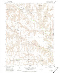
Medicine Creek and its many tributaries, including Dry Creek, Coyote Creek, and Spring Creek, carve a complex drainage pattern across this portion of Frontier County. The village of Stockville serves as the focal point of the area, situated near the County Fairground and surrounded by a network of rural townships like Sheridan and Sherman. The landscape is defined by its deep draws and ridges, most notably Saunders Canyon in the western reaches of the survey.
Find a feature on this map
21 named features on this map. Tap any name to fly to it.
Don’t see what you’re looking for? This feature index may not catch every label — zoom into the map to look around manually.
Map Details
Editions of this 1956 Stockville Map
3 editions found
Other maps of this area

1902 · Gothenburg
USGS Topo · 1:125,000

1954 · McCook
USGS Topo · 1:250,000

1956 · Freedom
USGS Topo · 1:24,000

1956 · Stockville NE
USGS Topo · 1:24,000

1956 · Moorefield
USGS Topo · 1:24,000

1956 · Quick NE
USGS Topo · 1:24,000

1956 · Curtis
USGS Topo · 1:24,000

1956 · Curtis SE
USGS Topo · 1:24,000

1956 · Bartley NW
USGS Topo · 1:24,000

1956 · Stockville SE
USGS Topo · 1:24,000