
1956 Map of White NE
USGS Topo · Published 1957About this map
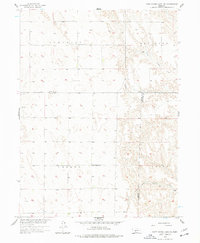
The undulating plains of Southwest Nebraska in the mid-1950s are defined here by a sparse but intentional network of rural institutions and drainage systems. This area, located where the borders of Lincoln, Hayes, and Frontier counties meet, shows a landscape centered on small community hubs like Ash Grove Cem and its nearby Ash Grove Sch. These points of assembly provided essential structure for the surrounding agricultural population in the Somerset and Medicine regions. The terrain is carved by the seasonal flow of North Brushy Creek and South Brushy Creek, which dictate the placement of roads and homesteads across the Valley and Laird districts. Notable for genealogists is the presence of Valley Sch, representing the one-room schoolhouse era that still persisted in the Missouri River Basin during this post-war development period.
Find a feature on this map
8 named features on this map. Tap any name to fly to it.
Don’t see what you’re looking for? This feature index may not catch every label — zoom into the map to look around manually.
Map Details
Editions of this 1956 White NE Map
2 editions found
Other maps of this area

1954 · McCook
USGS Topo · 1:250,000

1956 · Curtis SW
USGS Topo · 1:24,000

1956 · Curtis NW
USGS Topo · 1:24,000

1956 · Dickens
USGS Topo · 1:24,000

1956 · Somerset
USGS Topo · 1:24,000

1956 · Wellfleet
USGS Topo · 1:24,000

1957 · McCook
USGS Topo · 1:250,000

1958 · McCook
USGS Topo · 1:250,000

1973 · Camp Hayes Lake SE
USGS Topo · 1:24,000

1973 · Suttlers Canyon East
USGS Topo · 1:24,000