1973 Map of Camp Hayes Lake SE
USGS Topo · Published 1977About this map
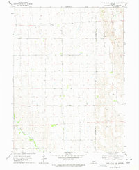
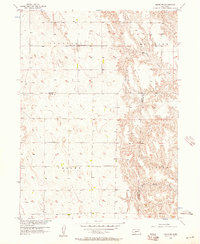
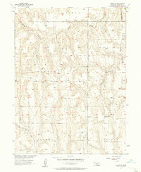
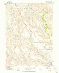
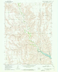
The rolling plains along the Hayes County and Frontier County line define this part of southwestern Nebraska as it was documented in the early 1970s. The landscape is primarily shaped by agricultural section lines and the drainages of Red Willow Creek in the southwest and Spring Creek in the northeast. Community life in this rural expanse is anchored by two distinct houses of worship: St John Ch situated in the north-central section and Evergreen Union Ch located further south. A single Radio Tower stands as a notable modern landmark amidst the vast network of section roads and scattered wells, illustrating the sparse settlement pattern typical of the High Plains during this era of agricultural development.
Find a feature on this map
6 named features on this map. Tap any name to fly to it.
Don’t see what you’re looking for? This feature index may not catch every label — zoom into the map to look around manually.
Map Details
Editions of this 1973 Camp Hayes Lake SE Map
This is the sole edition of this map. No revisions or reprints were ever made.
Other maps of this area

1954 · McCook
USGS Topo · 1:250,000
1956 · White NE
USGS Topo · 1:24,000
1956 · Curtis SW
USGS Topo · 1:24,000
1956 · Curtis NW
USGS Topo · 1:24,000

1957 · McCook
USGS Topo · 1:250,000

1958 · McCook
USGS Topo · 1:250,000

1970 · Quick
USGS Topo · 1:24,000
1970 · Burger Canyon East
USGS Topo · 1:24,000
1973 · Suttlers Canyon East
USGS Topo · 1:24,000
1973 · Burger Canyon West
USGS Topo · 1:24,000