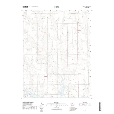
2017 Map of Quick
USGS Topo · Published 2017About this map
Quick sits as a quiet focal point in this portion of Frontier County, where the high plains terrain is defined by a network of seasonal drainages and essential water management. The landscape is marked by the deep incisions of Bee Canyon and the winding course of Spring Cr, which feeds into the larger reservoir systems of the region. Hugh Butler Lake dominates the southern portion of the sheet, illustrating the significant hydrological engineering required for agriculture and conservation in this part of Nebraska. Local history is anchored by the Garden Prairie Cem, providing a genealogical point of reference for families of the surrounding townships. The map reveals a structured grid of rural routes, including RD 732 and RD 381, which connect the scattered reservoirs such as Teel Reservoir Number 1 and Kuler Reservoir to the wider county infrastructure.
Find a feature on this map
24 named features on this map. Tap any name to fly to it.
Don’t see what you’re looking for? This feature index may not catch every label — zoom into the map to look around manually.
Map Details
Editions of this 2017 Quick Map
This is the sole edition of this map. No revisions or reprints were ever made.
Other maps of this area

1954 · McCook
USGS Topo · 1:250,000

1956 · Curtis SW
USGS Topo · 1:24,000

1956 · Quick NE
USGS Topo · 1:24,000

1956 · Curtis SE
USGS Topo · 1:24,000

1957 · McCook
USGS Topo · 1:250,000

1958 · McCook
USGS Topo · 1:250,000

1970 · Red Willow Dam
USGS Topo · 1:24,000

1970 · Quick
USGS Topo · 1:24,000

1970 · Burger Canyon SE
USGS Topo · 1:24,000

1970 · Quick SE
USGS Topo · 1:24,000