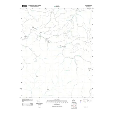
2011 Map of Quick
USGS Topo · Published 2011About this map
Campbells Creek and its many winding tributaries define the settlement patterns of this West Virginia landscape. Small communities like Quick, Coalridge, and Cinco are scattered throughout the narrow valley floors, connected by a network of rural roads such as Mill Creek Rd and Quick Rd. The geography is characterized by a dense system of hollows, including Rattlesnake Hollow and Tackett Hollow, which dictate the placement of homes and infrastructure. Notable landmarks that anchor the area include the Blount Post Office and the Mount Desert Lookout Tower on the eastern edge of the quadrangle. The naming conventions found here, such as Ugly Branch and Steepgut Hollow, reflect the local character of the terrain. This map captures the region's development along its waterways, showing how towns like Rensford and Annfred grew within the tight constraints of the creek systems.
Find a feature on this map
52 named features on this map. Tap any name to fly to it.
Don’t see what you’re looking for? This feature index may not catch every label — zoom into the map to look around manually.
Map Details
Editions of this 2011 Quick Map
This is the sole edition of this map. No revisions or reprints were ever made.
Other maps of this area

1897 · Kanawha Falls
USGS Topo · 1:125,000

1899 · Charleston
USGS Topo · 1:125,000

1900 · Kanawha Falls
USGS Topo · 1:125,000

1901 · Kanawha Falls
USGS Topo · 1:125,000

1907 · Clendenin
USGS Topo · 1:62,500

1908 · Montgomery
USGS Topo · 1:48,000

1909 · Charleston
USGS Topo · 1:62,500

1909 · Clendenin
USGS Topo · 1:62,500

1909 · Peytona
USGS Topo · 1:48,000

1910 · Montgomery
USGS Topo · 1:62,500