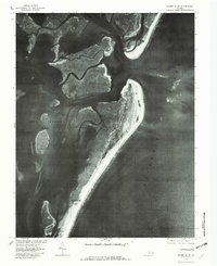
1978 Map of Quinby Inlet
USGS Topo · Published 1982About this map
Hog Island dominates this orthophotomap, showing the dynamic barrier island landscape of Virginia's Eastern Shore in the late 1970s. The aerial imagery captures the shifting sands and intricate tidal systems of the Chimney Pole Marsh and the wide expanse of Hog Island Bay. Of significant historical interest is the location of Broadwater, a settlement that once thrived on the island before the sea's encroachment forced its evacuation. This survey records the shoreline and sediment patterns at Quinby Inlet, providing a clear visual record of the barrier island's shape before decades of coastal erosion further altered its footprint. Unlike traditional line-drawn maps, the photography revealed here by the U.S. Geological Survey shows the actual density of vegetation and the exact reach of the Atlantic Ocean against the dunes.
Find a feature on this map
6 named features on this map. Tap any name to fly to it.
Don’t see what you’re looking for? This feature index may not catch every label — zoom into the map to look around manually.
Map Details
Editions of this 1978 Quinby Inlet Map
This is the sole edition of this map. No revisions or reprints were ever made.
Other maps of this area

1931 · Accomac
USGS Topo · 1:48,000

1935 · Accomac
USGS Topo · 1:62,500

1941 · Broadwater
USGS Topo · 1:62,500

1942 · Cobb Island
USGS Topo · 1:24,000

1942 · Great Machipongo Inlet
USGS Topo · 1:24,000

1942 · Little Machipongo Inlet
USGS Topo · 1:24,000

1942 · Nassawadox
USGS Topo · 1:24,000

1943 · Nassawadox
USGS Topo · 1:31,680

1943 · Exmore
USGS Topo · 1:24,000

1944 · Exmore
USGS Topo · 1:31,680