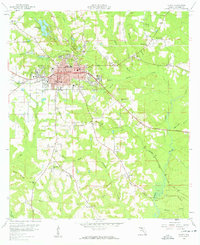
1959 Map of Quincy
USGS Topo · Published 1960About this map
The county seat of Quincy dominates this mid-century landscape, showing a dense street grid flanked by established institutions like Western Cem, Eastern Cem, and the Quincy High Sch. The town's economic foundations are visible in the industrial infrastructure of the Seaboard Air Line railroad and the nearby Tanyard and Santa Clara settlements. Outside the urban core, the terrain is defined by a network of drainage basins including Quincy Creek and the Little River, which supported several rural communities.
Find a feature on this map
50 named features on this map. Tap any name to fly to it.
Don’t see what you’re looking for? This feature index may not catch every label — zoom into the map to look around manually.
Map Details
Editions of this 1959 Quincy Map
2 editions found

Other maps of this area

1940 · Tallahassee
USGS Topo · 1:62,500

1942 · Tallahassee
USGS Topo · 1:62,500

1943 · Tallahassee
USGS Topo · 1:62,500

1943 · Lake Talquin
USGS Topo · 1:62,500

1954 · Tallahassee
USGS Topo · 1:250,000

1955 · Mt Pleasant
USGS Topo · 1:24,000

1956 · Havana North
USGS Topo · 1:24,000

1956 · Dogtown
USGS Topo · 1:24,000

1959 · Tallahassee
USGS Topo · 1:250,000

1959 · Gretna
USGS Topo · 1:24,000