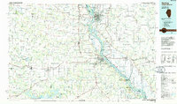
1986 Map of Quincy
USGS Topo · Published 1986About this map
The Mississippi River serves as the dominant spine of this mid-1980s landscape, dividing the urban center of Quincy, Illinois, from the floodplains and hills of northeast Missouri. This era shows a complex regional infrastructure, featuring the Clarence Cannon Dam to the south and the sprawling Hunnewell State Wildlife Area to the west. The map illustrates a mature transport network where the Burlington Northern RR and Norfolk and Western RR intersect with major highways like US Highway 61. Educational and municipal landmarks are well-represented, including John Wood Comm Col and Quincy Municipal Airport (Baldwin Field). Beyond the cities, the terrain is defined by a dense web of waterways such as the South Fabius River and Troublesome Creek, which historically dictated the placement of smaller settlements like Philadelphia and Steffenville.
Find a feature on this map
107 named features on this map. Tap any name to fly to it.
Don’t see what you’re looking for? This feature index may not catch every label — zoom into the map to look around manually.
Map Details
Editions of this 1986 Quincy Map
2 editions found
Other maps of this area

1890 · Louisiana
USGS Topo · 1:125,000

1890 · Mexico
USGS Topo · 1:125,000

1890 · Moberly
USGS Topo · 1:125,000

1903 · Kahoka
USGS Topo · 1:125,000

1903 · Palmyra
USGS Topo · 1:125,000

1903 · Edina
USGS Topo · 1:125,000

1925 · Quincy
USGS Topo · 1:62,500

1925 · Liberty
USGS Topo · 1:62,500

1926 · Pittsfield
USGS Topo · 1:62,500

1926 · Mt Sterling
USGS Topo · 1:62,500