
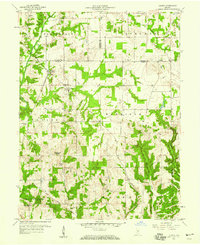
1958 Map of Quincy
USGS Topo · Published 1959About this map
Quincy stands at a crossroads of rail and rural life in the late 1950s, centered around the Monon railroad line. This corridor served as a vital artery through the hilly terrain of northern Owen County, connecting smaller settlements like Wallace Junction and Samaria to the wider region. The landscape is dotted with the indicators of a tight-knit community, including several country churches and family burial grounds such as Montgomery Chapel and the Little Mount Cem.
Find a feature on this map
36 named features on this map. Tap any name to fly to it.
Don’t see what you’re looking for? This feature index may not catch every label — zoom into the map to look around manually.
Map Details
Editions of this 1958 Quincy Map
2 editions found
Other maps of this area

1947 · Gosport
USGS Topo · 1:24,000

1949 · Quincy
USGS Topo · 1:24,000

1950 · Gosport
USGS Topo · 1:24,000

1953 · Indianapolis
USGS Topo · 1:250,000

1955 · Hall
USGS Topo · 1:24,000

1956 · Indianapolis
USGS Topo · 1:250,000

1956 · Cloverdale
USGS Topo · 1:24,000

1956 · Cataract
USGS Topo · 1:24,000

1956 · Eminence
USGS Topo · 1:24,000
1956 · Spencer
USGS Topo · 1:24,000