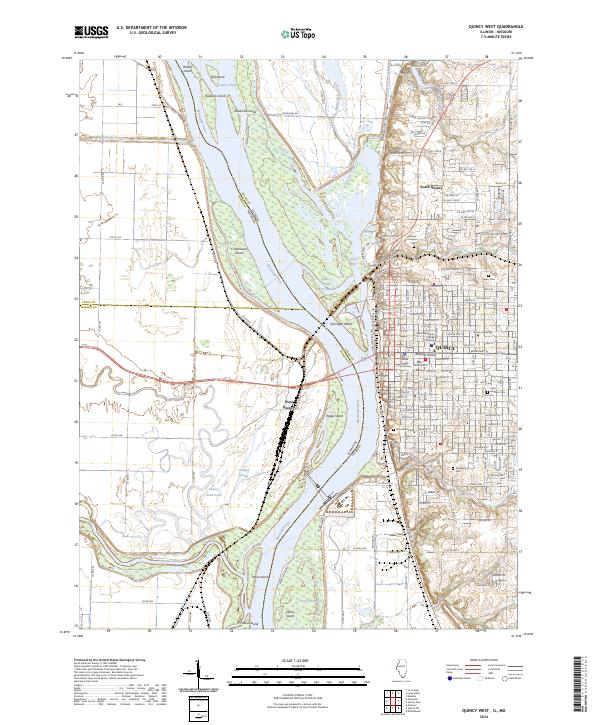
2024 Map of Quincy West
USGS Topo · Published 2024About this map
The Mississippi River acts as the central artery and state boundary between Illinois and Missouri on this survey, defining a landscape of complex waterways and river islands. The city of Quincy dominates the eastern bluffs, showing a dense urban grid that includes Quincy University and the Adams County Courthouse. The river’s braided character is evident in the numerous chutes and sloughs, such as Canton Chute and Crooked Slough, which separate significant landmasses like Quinsippi Island and Deadman Island.
Find a feature on this map
123 named features on this map. Tap any name to fly to it.
Don’t see what you’re looking for? This feature index may not catch every label — zoom into the map to look around manually.
Map Details
Editions of this 2024 Quincy West Map
This is the sole edition of this map. No revisions or reprints were ever made.
Other maps of this area

1903 · Kahoka
USGS Topo · 1:125,000

1903 · Palmyra
USGS Topo · 1:125,000

1925 · Quincy
USGS Topo · 1:62,500

1944 · Quincy
USGS Topo · 1:62,500

1945 · Quincy
USGS Topo · 1:62,500

1946 · Mendon
USGS Topo · 1:62,500

1948 · Quincy
USGS Topo · 1:250,000

1948 · Mendon
USGS Topo · 1:62,500

1949 · Maywood
USGS Topo · 1:24,000

1949 · Palmyra
USGS Topo · 1:24,000