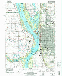
1996 Map of Quincy West
USGS Topo · Published 1997About this map
The Mississippi River dominates this landscape, serving as the border between Illinois and Missouri while shaping an intricate network of islands and side channels. The city of Quincy sits on the eastern bluff, its grid of streets such as Maine St and Broadway leading toward the riverfront and the Quincy Mem Bridge. The map captures the industrial and logistical infrastructure of the mid-1990s, including Lock and Dam No 21 and various mines south of the city. Extensive conservation areas like the Mark Twain Wildlife Refuge and the Canton Chute Public Use Area occupy the western lowlands, where the Fabius River and Crooked Slough wind through the floodplain. Genealogists will find several major burial grounds documented, including St Boniface Cem and Sunset Cem, alongside many local parks that define the city's green space.
Find a feature on this map
79 named features on this map. Tap any name to fly to it.
Don’t see what you’re looking for? This feature index may not catch every label — zoom into the map to look around manually.
Map Details
Editions of this 1996 Quincy West Map
This is the sole edition of this map. No revisions or reprints were ever made.
Other maps of this area

1903 · Kahoka
USGS Topo · 1:125,000

1903 · Palmyra
USGS Topo · 1:125,000

1925 · Quincy
USGS Topo · 1:62,500

1944 · Quincy
USGS Topo · 1:62,500

1945 · Quincy
USGS Topo · 1:62,500

1946 · Mendon
USGS Topo · 1:62,500

1948 · Quincy
USGS Topo · 1:250,000

1948 · Mendon
USGS Topo · 1:62,500

1949 · Maywood
USGS Topo · 1:24,000

1949 · Palmyra
USGS Topo · 1:24,000