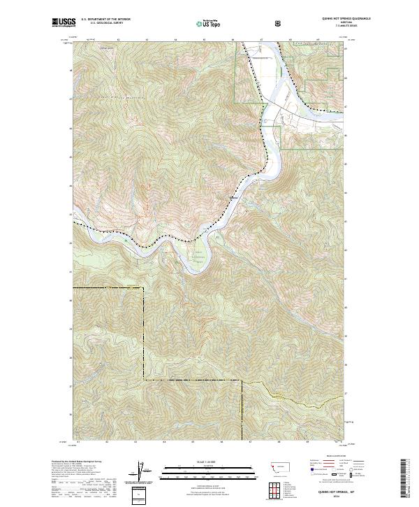
2024 Map of Quinns Hot Springs
USGS Topo · Published 2024About this map
Quinns Hot Springs serves as a central landmark in this rugged river corridor where the Flathead River joins the Clark Fork. The terrain is defined by the steep transitions between the Cabinet Mountains to the north and the Coeur d'Alene Mountains to the west, almost entirely contained within the Lolo National Forest. The small settlement at Quinns represents a pocket of human activity amidst a landscape primarily utilized for recreation and transit, with drainage systems like Sheep Creek and Wallace Creek carving deep paths through the timbered slopes.
Find a feature on this map
38 named features on this map. Tap any name to fly to it.
Don’t see what you’re looking for? This feature index may not catch every label — zoom into the map to look around manually.
Map Details
Editions of this 2024 Quinns Hot Springs Map
This is the sole edition of this map. No revisions or reprints were ever made.
Other maps of this area

1956 · Wallace
USGS Topo · 1:250,000

1959 · Tarkio
USGS Topo · 1:62,500

1959 · Perma
USGS Topo · 1:62,500

1959 · Plains
USGS Topo · 1:62,500

1960 · Wallace
USGS Topo · 1:250,000

1960 · Superior
USGS Topo · 1:62,500

1983 · Horsehead Peak
USGS Topo · 1:24,000
1984 · Paradise
USGS Topo · 1:24,000
1984 · Sunrise Spring
USGS Topo · 1:24,000
1984 · Knowles
USGS Topo · 1:24,000