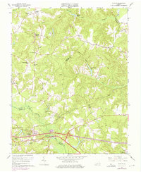
1965 Map of Quinton
USGS Topo · Published 1975About this map
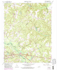
The Chickahominy River serves as the dividing line between New Kent and Henrico counties, surrounded by a complex network of wetlands including Higgins Swamp and Crumps Swamp. In the mid-1960s, the landscape was defined by small crossroads settlements like Quinton and Bottoms Bridge, alongside established agrarian sites such as Orapax Farms. The area’s historical infrastructure is evident in the presence of an Old Railroad Grade near Woodlawn and the Southern railroad line cutting through the southern portion of the quadrangle. Local genealogy is well-represented through numerous rural religious and educational sites, including Antioch Sch Cem, Black Creek Ch, and Prospect Ch. The interior is dotted with millponds like Flanagans Millpond, while newer developments like Bradley Acres and Woodhaven Shores indicate shifting residential patterns toward the late 20th century.
Find a feature on this map
53 named features on this map. Tap any name to fly to it.
Don’t see what you’re looking for? This feature index may not catch every label — zoom into the map to look around manually.
Map Details
Editions of this 1965 Quinton Map
5 editions found
Other maps of this area

1894 · Bermuda Hundred
USGS Topo · 1:62,500

1894 · Richmond
USGS Topo · 1:62,500

1895 · Richmond
USGS Topo · 1:62,500

1918 · Charles City
USGS Topo · 1:62,500

1920 · King William
USGS Topo · 1:62,500

1934 · Seven Pines
USGS Topo · 1:24,000

1938 · Dutch Gap
USGS Topo · 1:24,000

1938 · Seven Pines
USGS Topo · 1:31,680

1938 · Studley
USGS Topo · 1:31,680

1943 · Dutch Gap
USGS Topo · 1:31,680