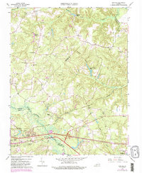
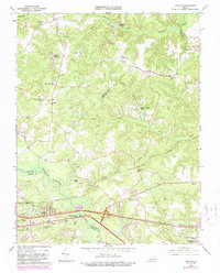
1965 Map of Quinton
USGS Topo · Published 1987About this map
The Chickahominy River forms a significant natural boundary on this mid-century survey, dividing the lowlands of Henrico and New Kent counties. Much of the southern landscape is defined by extensive wetlands including Higgins Swamp and Crumps Swamp, which are bypassed by the Southern railroad line. At Bottoms Bridge, a historic crossing point, the road network begins to modernize with the presence of Interchange 43.
Find a feature on this map
50 named features on this map. Tap any name to fly to it.
Don’t see what you’re looking for? This feature index may not catch every label — zoom into the map to look around manually.
Map Details
Editions of this 1965 Quinton Map
5 editions found
Other maps of this area

1894 · Bermuda Hundred
USGS Topo · 1:62,500

1894 · Richmond
USGS Topo · 1:62,500

1895 · Richmond
USGS Topo · 1:62,500

1918 · Charles City
USGS Topo · 1:62,500

1920 · King William
USGS Topo · 1:62,500

1934 · Seven Pines
USGS Topo · 1:24,000

1938 · Dutch Gap
USGS Topo · 1:24,000

1938 · Seven Pines
USGS Topo · 1:31,680

1938 · Studley
USGS Topo · 1:31,680

1943 · Dutch Gap
USGS Topo · 1:31,680