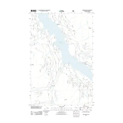
2011 Map of Quintonkon
USGS Topo · Published 2011About this map
Hungry Horse Reservoir dominates this Flathead County landscape, where the waters are fed by a complex network of drainages including Sullivan Creek and Taylor Creek. This 2011 survey illustrates a remote wilderness character defined by steep elevations such as Battery Mountain and Kah Mountain. Human activity is concentrated along the shoreline and forest access routes, notably at Baptiste Graye and the small settlement of Quintonkon. Recreational points like Devils Corkscrew Campground and Peters Creek Campground serve as the primary landmarks in this densely forested region. The presence of E Side Rd and W Side Rd traces the rim of the reservoir, providing the essential infrastructure for forestry and sportsmen accessing the Peters Creek Sportsmans Access.
Find a feature on this map
29 named features on this map. Tap any name to fly to it.
Don’t see what you’re looking for? This feature index may not catch every label — zoom into the map to look around manually.
Map Details
Editions of this 2011 Quintonkon Map
This is the sole edition of this map. No revisions or reprints were ever made.
Other maps of this area

1914 · Nyack
USGS Topo · 1:125,000

1955 · Choteau
USGS Topo · 1:250,000

1957 · Choteau
USGS Topo · 1:250,000

1958 · Choteau
USGS Topo · 1:250,000

1958 · Circus Peak
USGS Topo · 1:24,000

1958 · Nimrod
USGS Topo · 1:24,000

1958 · Quintonkon
USGS Topo · 1:24,000

1958 · Felix Peak
USGS Topo · 1:24,000

1960 · Cut Bank
USGS Topo · 1:250,000

1962 · Choteau
USGS Topo · 1:250,000