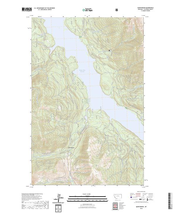
2024 Map of Quintonkon
USGS Topo · Published 2024About this map
Hungry Horse Reservoir dominates this high-elevation landscape within the Flathead National Forest, where the waters of the South Fork Flathead River are held back by the massive dam to the north. The terrain is marked by steep ridges and named peaks such as Battery Mtn and Kah Mtn, with a network of Forest Service roads including the W Side Rd and E Side Rd tracing the shorelines. Historical interest is centered on the Baptiste Grave and Baptiste Springs near the mouth of Baptiste Creek, providing a localized human connection to this wilderness area. The settlement of Quintonkon sits south of the reservoir's reach, positioned along Quintonkon Creek. In the northeast, the map crosses into the Great Bear Wilderness near Prospector Mtn, illustrating the transition from managed forest lands to strictly protected wilderness.
Find a feature on this map
43 named features on this map. Tap any name to fly to it.
Don’t see what you’re looking for? This feature index may not catch every label — zoom into the map to look around manually.
Map Details
Editions of this 2024 Quintonkon Map
This is the sole edition of this map. No revisions or reprints were ever made.
Other maps of this area

1914 · Nyack
USGS Topo · 1:125,000

1955 · Choteau
USGS Topo · 1:250,000

1957 · Choteau
USGS Topo · 1:250,000

1958 · Choteau
USGS Topo · 1:250,000

1958 · Circus Peak
USGS Topo · 1:24,000

1958 · Nimrod
USGS Topo · 1:24,000

1958 · Quintonkon
USGS Topo · 1:24,000

1958 · Felix Peak
USGS Topo · 1:24,000

1960 · Cut Bank
USGS Topo · 1:250,000

1962 · Choteau
USGS Topo · 1:250,000