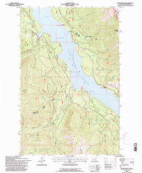
1994 Map of Quintonkon
USGS Topo · Published 1997About this map
The South Fork Flathead River valley is dominated by the waters of the Hungry Horse Reservoir, a landscape defined by the 1990s as a mix of remote wilderness and managed timberland. The settlement of Quintonkon sits near the namesake Quintonkon Creek, while more enigmatic markers like Baptiste Grave and Baptiste Springs hint at earlier personal histories along Baptiste Creek. Higher elevations are marked by distinctive peaks such as Battery Mountain and Prospector Mountain, with the latter standing near the edge of the Great Bear Wilderness.
Find a feature on this map
33 named features on this map. Tap any name to fly to it.
Don’t see what you’re looking for? This feature index may not catch every label — zoom into the map to look around manually.
Map Details
Editions of this 1994 Quintonkon Map
This is the sole edition of this map. No revisions or reprints were ever made.
Other maps of this area

1914 · Nyack
USGS Topo · 1:125,000

1955 · Choteau
USGS Topo · 1:250,000

1957 · Choteau
USGS Topo · 1:250,000

1958 · Choteau
USGS Topo · 1:250,000

1958 · Circus Peak
USGS Topo · 1:24,000

1958 · Nimrod
USGS Topo · 1:24,000

1958 · Quintonkon
USGS Topo · 1:24,000

1958 · Felix Peak
USGS Topo · 1:24,000

1960 · Cut Bank
USGS Topo · 1:250,000

1962 · Choteau
USGS Topo · 1:250,000