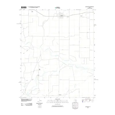
2010 Map of Quitaque
USGS Topo · Published 2010About this map
Quitaque serves as the primary hub of this Texas Panhandle landscape, where the town layout meets a network of rural county roads. The drainage systems of Los Lingos Creek and Quitaque Creek carve through the terrain, defining the movement of water and the placement of early settlements. Small outposts and place names like Gasoline, Gray Mule, and Fairmont suggest a history of decentralized farming communities and local industry that once supported this portion of Briscoe County.
Find a feature on this map
38 named features on this map. Tap any name to fly to it.
Don’t see what you’re looking for? This feature index may not catch every label — zoom into the map to look around manually.
Map Details
Editions of this 2010 Quitaque Map
This is the sole edition of this map. No revisions or reprints were ever made.
Other maps of this area

1954 · Plainview
USGS Topo · 1:250,000

1958 · Plainview
USGS Topo · 1:250,000

1967 · Quitaque
USGS Topo · 1:24,000

1967 · Quitaque Peaks
USGS Topo · 1:24,000

1967 · Edgemon Lake
USGS Topo · 1:24,000

1967 · Hay Lake
USGS Topo · 1:24,000

1967 · Flomot
USGS Topo · 1:24,000
1967 · Wilson Creek
USGS Topo · 1:24,000

1967 · Turkey
USGS Topo · 1:24,000

1967 · Lake Theo
USGS Topo · 1:24,000