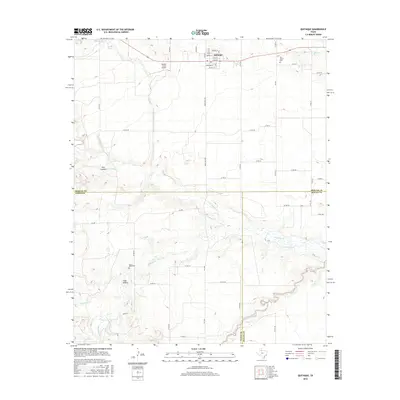
2016 Map of Quitaque
USGS Topo · Published 2016About this map
Quitaque serves as the primary hub in this West Texas landscape, positioned at the convergence of several county roads and ranch-to-market routes. The settlement's street grid is clearly defined, featuring Main St, Jones St, and Russell St, with a local Po located in the town center. The surrounding terrain is characterized by a complex network of canyons and drainage systems, including Pole Canyon and the winding course of Quitaque Cr. These waterways, along with Los Lingos Cr and Hackberry Cr, carve through the landscape, illustrating the natural erosion patterns typical of the region's caprock edge. Genealogy researchers will find interest in Rest Haven Cem northeast of the town and the more isolated Gray Mule Cem to the southwest. The presence of Henson Farms Airport and Puckett Lake further highlight the intersection of agricultural utility and the area's hydrology.
Find a feature on this map
52 named features on this map. Tap any name to fly to it.
Don’t see what you’re looking for? This feature index may not catch every label — zoom into the map to look around manually.
Map Details
Editions of this 2016 Quitaque Map
This is the sole edition of this map. No revisions or reprints were ever made.
Other maps of this area

1954 · Plainview
USGS Topo · 1:250,000

1958 · Plainview
USGS Topo · 1:250,000

1967 · Quitaque
USGS Topo · 1:24,000

1967 · Quitaque Peaks
USGS Topo · 1:24,000

1967 · Edgemon Lake
USGS Topo · 1:24,000

1967 · Hay Lake
USGS Topo · 1:24,000

1967 · Flomot
USGS Topo · 1:24,000
1967 · Wilson Creek
USGS Topo · 1:24,000

1967 · Turkey
USGS Topo · 1:24,000

1967 · Lake Theo
USGS Topo · 1:24,000