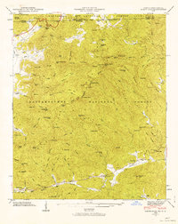
1946 Map of Rabun Bald
USGS Topo · Published 1963About this map
The Continental Divide winds along the Blue Ridge, defining the high-altitude landscape where the Chattahoochee National Forest meets the Nantahala National Forest. This 1946 field examination captures the scattered mountain communities of Rabun County before modern expansion, centering on the prominent peak of Rabun Bald and its Lookout Tower. Below the heights, the settlement pattern follows the water, with the Antioch community and several family burial grounds like Kelly Cem and Hale Church Cem tucked into the valleys of Warwoman Creek and Mud Creek. The geography is defined by numerous gaps and knobs, such as Rabun Gap and Flint Knob, which dictated early travel routes. Evidence of rural infrastructure remains visible through the Locust School at Locust School Gap and the Power Plant near Estatoah Falls, marking a moment when mid-century development began to touch these highland reaches.
Find a feature on this map
111 named features on this map. Tap any name to fly to it.
Don’t see what you’re looking for? This feature index may not catch every label — zoom into the map to look around manually.
Map Details
Editions of this 1946 Rabun Bald Map
4 editions found
Other maps of this area

1886 · Walhalla
USGS Topo · 1:125,000

1891 · Cowee
USGS Topo · 1:125,000

1892 · Walhalla
USGS Topo · 1:125,000

1896 · Walhalla
USGS Topo · 1:125,000

1897 · Cowee
USGS Topo · 1:125,000

1907 · Cowee
USGS Topo · 1:125,000

1935 · Prentiss
USGS Topo · 1:24,000

1935 · Dillard
USGS Topo · 1:24,000

1935 · Scaly
USGS Topo · 1:24,000

1935 · Rabun Bald
USGS Topo · 1:24,000