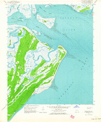
1957 Map of Raccoon Key
USGS Topo · Published 1964About this map
Ossabaw Island dominates this 1950s survey, revealing a landscape defined by saltwater marshes, maritime forests, and tidal estuaries. The island's interior is navigated by a specialized network of paths including Cabbage Garden Road and Main Road, which connect isolated sites like Middle Place and Torreys Landing. This environment reflects the historic coastal land use of Georgia's Sea Islands, where agricultural efforts and small settlements were intricately tied to the surrounding waterways and natural ponds like Egret Pond and Rice Pond. To the north, the Intracoastal Waterway cuts through Green Island Sound, marking the vital maritime corridor between the mainland and the Atlantic Ocean. The topography shows a transition from the marshy Middle Marsh Islands to the firm ground of Spider Ridge, illustrating the geological complexity of this barrier island ecosystem.
Find a feature on this map
51 named features on this map. Tap any name to fly to it.
Don’t see what you’re looking for? This feature index may not catch every label — zoom into the map to look around manually.
Map Details
Editions of this 1957 Raccoon Key Map
2 editions found
Other maps of this area

1920 · Wassaw Sound
USGS Topo · 1:62,500

1928 · St Catherines Island
USGS Topo · 1:62,500

1943 · St Catherines Island
USGS Topo · 1:62,500

1944 · Ossabaw Island
USGS Topo · 1:62,500

1945 · St. Catherine's Island
USGS Topo · 1:62,500

1945 · Ossabaw Island
USGS Topo · 1:62,500

1945 · Wassaw Sound
USGS Topo · 1:62,500

1946 · Brunswick
USGS Topo · 1:250,000

1948 · Brunswick
USGS Topo · 1:250,000
1954 · St Catherines Sound
USGS Topo · 1:24,000