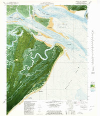
1979 Map of Raccoon Key
USGS Topo · Published 1980About this map
Ossabaw Island dominates this coastal survey, revealing a landscape of dense maritime forests, expansive marshes, and intricate tidal waterways. This orthophotomap combines traditional topographic contours with aerial imagery to detail the island's unique geography, from the interior Spider Ridge to the isolated freshwater Goose Pond. Small settlements and landings like Morell, Torreys Landing, and Horse Hammock are scattered along the western marsh edges, connected by the unpaved Main Road. To the north, the Intracoastal Waterway threads through the Ogeechee River and Green Island Sound, passing the notoriously narrow passage at Hell Gate. The map illustrates a dynamic shoreline where the Atlantic Ocean meets Bradley Point, noting several areas as being subject to frequent change, highlighting the shifting nature of the Georgia coast.
Find a feature on this map
51 named features on this map. Tap any name to fly to it.
Don’t see what you’re looking for? This feature index may not catch every label — zoom into the map to look around manually.
Map Details
Editions of this 1979 Raccoon Key Map
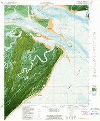
2 editions found
Other maps of this area

1920 · Wassaw Sound
USGS Topo · 1:62,500

1928 · St Catherines Island
USGS Topo · 1:62,500

1943 · St Catherines Island
USGS Topo · 1:62,500

1944 · Ossabaw Island
USGS Topo · 1:62,500

1945 · St. Catherine's Island
USGS Topo · 1:62,500

1945 · Ossabaw Island
USGS Topo · 1:62,500

1945 · Wassaw Sound
USGS Topo · 1:62,500

1946 · Brunswick
USGS Topo · 1:250,000

1948 · Brunswick
USGS Topo · 1:250,000
1954 · St Catherines Sound
USGS Topo · 1:24,000