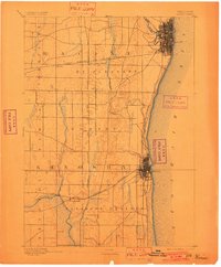
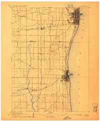
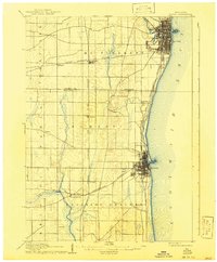
1905 Map of Racine
USGS Topo · Published 1905About this map
Racine and Kenosha emerge as the primary industrial and transit hubs along the Lake Michigan shoreline at the turn of the century. This survey, revised by topographers H. M. Wilson and Robert Muldrow, reveals a landscape defined by an intensive network of rail lines supporting the region's rapid growth. The intersection of the Chicago Milwaukee and St Paul Railroad and the Chicago and Northwestern Railroad creates vital junctions at Corliss and Truesdell, while the Chicago and Electric R. R. hugs the coast between major settlements. Beyond the growing urban centers, smaller communities like Sylvania, Somers, and Ivesgrove anchor the surrounding townships of Mt Pleasant and Yorkville. The drainage of the Root River and Pike River towards the lake contrasts with the westward flow of the Des Plaines River, illustrating the subtle continental divide that shaped early infrastructure and agricultural development in this corner of Wisconsin.
Find a feature on this map
26 named features on this map. Tap any name to fly to it.
Don’t see what you’re looking for? This feature index may not catch every label — zoom into the map to look around manually.
Map Details
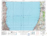
Editions of this 1905 Racine Map
3 editions found
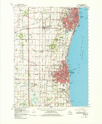
Historical Maps of Downtown Through Time
6 maps found