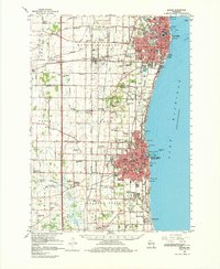
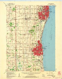
1959 Map of Racine
USGS Topo · Published 1980About this map
The urban and industrial centers of Racine and Kenosha anchor this late 1950s survey of the Lake Michigan shoreline. While the cities show dense street grids and prominent infrastructure like waterworks and sewage disposal plants, the surrounding townships of Mount Pleasant and Pleasant Prairie remain heavily defined by an intricate network of country schools and rural cemeteries. Small crossroads and hamlets such as Sylvania, Truesdell, and Ives Grove dot the landscape, many situated along the rail corridors of the Chicago and North Western and the Chicago Milwaukee St Paul and Pacific railroads.
Find a feature on this map
102 named features on this map. Tap any name to fly to it.
Don’t see what you’re looking for? This feature index may not catch every label — zoom into the map to look around manually.
Map Details
Editions of this 1959 Racine Map
2 editions found
Other maps of this area

1891 · Bayview
USGS Topo · 1:62,500

1891 · Muskego
USGS Topo · 1:62,500

1892 · Racine
USGS Topo · 1:62,500

1893 · Silver Lake
USGS Topo · 1:62,500

1901 · Bayview
USGS Topo · 1:62,500

1901 · Muskego
USGS Topo · 1:62,500

1905 · Racine
USGS Topo · 1:62,500

1906 · Silver Lake
USGS Topo · 1:62,500

1906 · Waukegan
USGS Topo · 1:62,500

1908 · Waukegan
USGS Topo · 1:62,500