
1958 Map of Racine
USGS Topo · Published 1971About this map
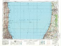
Lake Michigan dominates the center of this mid-century survey, dividing the industrial corridors of southeast Wisconsin and northeast Illinois from the fruit-growing and timbered shores of western Michigan. On the western shore, the urban expansion from Milwaukee south through Racine and Kenosha to the northern edge of Chicago is clearly marked by a dense grid of infrastructure and military installations. Key landmarks such as the Naval Training Center Great Lakes and Fort Sheridan underscore the strategic importance of this coastline during the Cold War era.
Find a feature on this map
173 named features on this map. Tap any name to fly to it.
Don’t see what you’re looking for? This feature index may not catch every label — zoom into the map to look around manually.
Map Details
Editions of this 1958 Racine Map
3 editions found
Other maps of this area

1889 · Chicago
USGS Topo · 1:62,500

1891 · Bayview
USGS Topo · 1:62,500

1891 · Chicago
USGS Topo · 1:62,500

1891 · Riverside
USGS Topo · 1:62,500

1891 · Muskego
USGS Topo · 1:62,500

1892 · Milwaukee
USGS Topo · 1:62,500

1892 · Waukesha
USGS Topo · 1:62,500

1892 · Racine
USGS Topo · 1:62,500

1893 · Riverside
USGS Topo · 1:62,500

1893 · Silver Lake
USGS Topo · 1:62,500