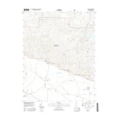
2015 Map of Raddle
USGS Topo · Published 2015About this map
Shawnee National Forest dominates the topography of this Illinois region, where high ridges like Dry Hill and Gum Ridge give way to the bottomlands along the Mississippi River. The small settlements of Glenn, Raddle, and Crain are situated on the flatter terrain to the west and south, connected by the Great River Rd. This landscape is marked by numerous family-named cemeteries such as Koehn Cem, Wilson Cem, and McBride Cem, which reflect the area's ancestral homesteads.
Find a feature on this map
60 named features on this map. Tap any name to fly to it.
Don’t see what you’re looking for? This feature index may not catch every label — zoom into the map to look around manually.
Map Details
Editions of this 2015 Raddle Map
This is the sole edition of this map. No revisions or reprints were ever made.
Other maps of this area

1910 · Murphysboro
USGS Topo · 1:62,500

1916 · Campbell Hill
USGS Topo · 1:62,500

1918 · Altenburg
USGS Topo · 1:62,500

1918 · Campbell Hill
USGS Topo · 1:62,500

1924 · Alto Pass
USGS Topo · 1:62,500

1925 · Altenburg
USGS Topo · 1:62,500

1938 · Murphysboro
USGS Topo · 1:62,500

1947 · Alto Pass
USGS Topo · 1:62,500

1947 · Crosstown
USGS Topo · 1:24,000

1947 · Gorham
USGS Topo · 1:24,000