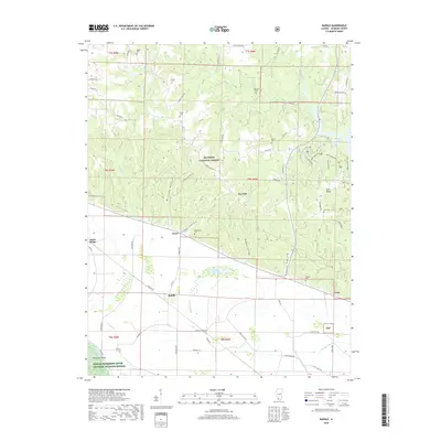
2018 Map of Raddle
USGS Topo · Published 2018About this map
Shawnee National Forest covers much of this landscape in Jackson County, where the rugged topography of southern Illinois meets the bottomlands of the Mississippi River. The settlement of Raddle sits on the flat expanse near the river, while smaller communities like Jones Ridge, Glenn, and Crain are distributed along the base of the rising bluffs. Local genealogy is well-documented through a high density of family burial grounds, including the Wilson Cem, Jones Cem, and McBride Cem scattered across the hills.
Find a feature on this map
67 named features on this map. Tap any name to fly to it.
Don’t see what you’re looking for? This feature index may not catch every label — zoom into the map to look around manually.
Map Details
Editions of this 2018 Raddle Map
This is the sole edition of this map. No revisions or reprints were ever made.
Other maps of this area

1910 · Murphysboro
USGS Topo · 1:62,500

1916 · Campbell Hill
USGS Topo · 1:62,500

1918 · Altenburg
USGS Topo · 1:62,500

1918 · Campbell Hill
USGS Topo · 1:62,500

1924 · Alto Pass
USGS Topo · 1:62,500

1925 · Altenburg
USGS Topo · 1:62,500

1938 · Murphysboro
USGS Topo · 1:62,500

1947 · Alto Pass
USGS Topo · 1:62,500

1947 · Crosstown
USGS Topo · 1:24,000

1947 · Gorham
USGS Topo · 1:24,000