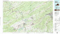
1982 Map of Radford
USGS Topo · Published 1983About this map
The New River carves a dramatic path through the heart of the New River Valley in the early 1980s, anchoring a landscape where industrial facilities like the Radford Army Ammunition Plant coexist with the outdoor recreation of Claytor Lake State Park. The region's transport identity is clearly defined by the Interstate 81 corridor and the Norfolk and Western railway, connecting established centers like Radford, Blacksburg, and Christiansburg.
Find a feature on this map
123 named features on this map. Tap any name to fly to it.
Don’t see what you’re looking for? This feature index may not catch every label — zoom into the map to look around manually.
Map Details
Editions of this 1982 Radford Map
2 editions found
Other maps of this area

1887 · Pocahontas
USGS Topo · 1:125,000

1887 · Hinton
USGS Topo · 1:125,000

1887 · Lewisburg
USGS Topo · 1:125,000

1889 · Hillsville
USGS Topo · 1:125,000

1889 · Wytheville
USGS Topo · 1:125,000

1890 · Roanoke
USGS Topo · 1:125,000

1890 · Dublin
USGS Topo · 1:125,000

1890 · Christiansburg
USGS Topo · 1:125,000

1891 · Roanoke
USGS Topo · 1:125,000

1891 · Lewisburg
USGS Topo · 1:125,000