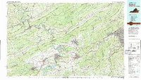
1982 Map of Radford
USGS Topo · Published 1983About this map
The New River carves a deep path through the Ridge and Valley province, anchoring a landscape where academic centers and industrial sites meet the high peaks of the Jefferson National Forest. This 1980s era is defined by the significant footprint of Vpi in Blacksburg and the sprawling Radford Army Ammunition Plant situated along the river bends. The map details the complex rail infrastructure of the Norfolk and Western line as it follows the water gaps through Peters Mountain and East River Mountain.
Find a feature on this map
134 named features on this map. Tap any name to fly to it.
Don’t see what you’re looking for? This feature index may not catch every label — zoom into the map to look around manually.
Map Details
Editions of this 1982 Radford Map
2 editions found
Other maps of this area

1887 · Pocahontas
USGS Topo · 1:125,000

1887 · Hinton
USGS Topo · 1:125,000

1887 · Lewisburg
USGS Topo · 1:125,000

1889 · Hillsville
USGS Topo · 1:125,000

1889 · Wytheville
USGS Topo · 1:125,000

1890 · Roanoke
USGS Topo · 1:125,000

1890 · Dublin
USGS Topo · 1:125,000

1890 · Christiansburg
USGS Topo · 1:125,000

1891 · Roanoke
USGS Topo · 1:125,000

1891 · Lewisburg
USGS Topo · 1:125,000