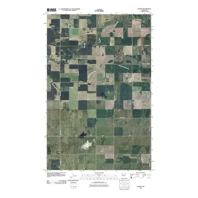
2010 Map of Radium
USGS Topo · Published 2010About this map
Radium serves as the focal point of this northwestern Minnesota landscape, where the agricultural grid is intersected by the winding course of the Snake River. The settlement's proximity to the Immanuel Cemetery reflects the deep-rooted community history of Marshall County, as established homesteads and family farms were historically organized around these local landmarks. The drainage of the region is defined by the South Branch Snake River, which meanders through the flat terrain, influencing the placement of early infrastructure. A network of secondary roads, including County Hwy-113 and County Hwy-65, connects the dispersed rural residences, illustrating the transition from traditional farming patterns to the modern transportation corridors of the early 21st century.
Find a feature on this map
14 named features on this map. Tap any name to fly to it.
Don’t see what you’re looking for? This feature index may not catch every label — zoom into the map to look around manually.
Map Details
Editions of this 2010 Radium Map
This is the sole edition of this map. No revisions or reprints were ever made.
Other maps of this area

1918 · Angus
USGS Topo · 1:62,500

1918 · Viking
USGS Topo · 1:62,500

1952 · Thief River Falls
USGS Topo · 1:250,000

1956 · Thief River Falls
USGS Topo · 1:250,000

1956 · Florian
USGS Topo · 1:62,500

1957 · Thief River Falls
USGS Topo · 1:250,000

1957 · Newfolden
USGS Topo · 1:62,500

1959 · Viking
USGS Topo · 1:24,000
1959 · Viking SW
USGS Topo · 1:24,000

1961 · Radium
USGS Topo · 1:24,000