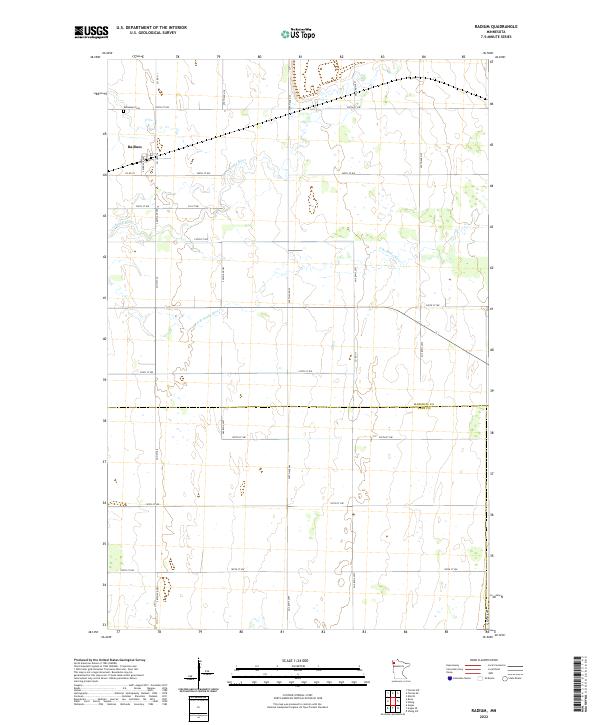
2022 Map of Radium
USGS Topo · Published 2022About this map
The unincorporated community of Radium stands as a primary landmark in this survey of northwestern Minnesota, situated along the Co Hwy 36 corridor. The landscape is defined by the meandering path of the Snake River and its tributary, the S Br Snake River, which carve through the grid of agricultural section lines. For genealogists and local historians, the Immanuel Cem northwest of the town center offers a specific point of interest for tracing family roots in this rural township. The map also delineates the jurisdictional boundary between Marshall Co and Polk Co, showing how the local road network, including Co Rd 111 and Co Rd 35, serves the scattered farmsteads and rural properties that characterize this region's quiet agricultural economy.
Find a feature on this map
28 named features on this map. Tap any name to fly to it.
Don’t see what you’re looking for? This feature index may not catch every label — zoom into the map to look around manually.
Map Details
Editions of this 2022 Radium Map
This is the sole edition of this map. No revisions or reprints were ever made.
Other maps of this area

1918 · Angus
USGS Topo · 1:62,500

1918 · Viking
USGS Topo · 1:62,500

1952 · Thief River Falls
USGS Topo · 1:250,000

1956 · Thief River Falls
USGS Topo · 1:250,000

1956 · Florian
USGS Topo · 1:62,500

1957 · Thief River Falls
USGS Topo · 1:250,000

1957 · Newfolden
USGS Topo · 1:62,500

1959 · Viking
USGS Topo · 1:24,000
1959 · Viking SW
USGS Topo · 1:24,000

1961 · Radium
USGS Topo · 1:24,000