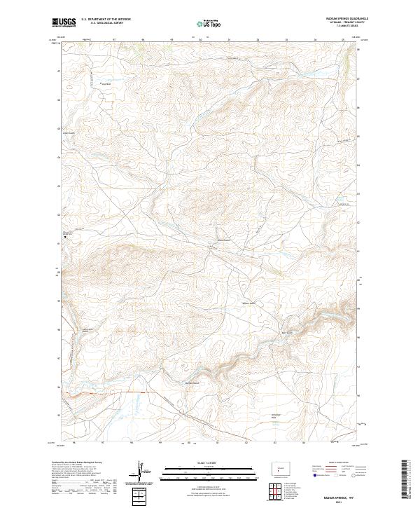
2021 Map of Radium Springs
USGS Topo · Published 2021About this map
Radium Springs and the historic Oregon Trl intersect in this high-desert landscape of central Wyoming. The map documents a critical corridor of western migration where the Sweetwater River and its tributaries, such as Strawberry Cr and Granite Cr, dictate the movement of both modern roads and historic paths. The presence of the Rock Creek Hollow Cem near Lewiston Rd serves as a reminder of the human toll along these westward routes, while the Continental Divide National Scenic Trl follows the high ground to the south.
Find a feature on this map
28 named features on this map. Tap any name to fly to it.
Don’t see what you’re looking for? This feature index may not catch every label — zoom into the map to look around manually.
Map Details
Editions of this 2021 Radium Springs Map
This is the sole edition of this map. No revisions or reprints were ever made.
Other maps of this area

1953 · Lewiston Lakes
USGS Topo · 1:24,000

1953 · Gravel Spring
USGS Topo · 1:24,000

1953 · Radium Springs
USGS Topo · 1:24,000

1953 · Schlichting Mountain
USGS Topo · 1:24,000

1953 · Atlantic City
USGS Topo · 1:24,000

1954 · Miners Delight
USGS Topo · 1:24,000

1955 · Lander
USGS Topo · 1:250,000

1958 · Lander
USGS Topo · 1:250,000
1958 · Schoettlin Mountain
USGS Topo · 1:24,000

1958 · Circle Bar Lake
USGS Topo · 1:24,000