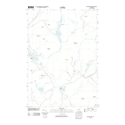
2010 Map of Ragged Lake
USGS Topo · Published 2010About this map
Adirondack Park dominates this terrain, characterized by a complex network of high peaks and water systems in the northern forest. The central drainage of Ragged Lake is fed by Tait Brook and Bell Brook, eventually flowing south through the Ragged Lake Outlet toward the Salmon River. This 2010 survey highlights the industrial and transport history of the region, specifically noted through features like the Upper Kilns and Middle Kilns situated along Kiln Rd. The settlement of Bryants Mill sits on the western edge near Mountain View Lake, providing a focal point for local historical research. To the south, the Plumadore Range and Wolf Pond Mountain define the high ground, while the corridor of the D & H Rd traces the historical path of the Delaware and Hudson railroad through the wilderness, connecting remote outposts like Plumadore Pond and Wolf Pond.
Find a feature on this map
54 named features on this map. Tap any name to fly to it.
Don’t see what you’re looking for? This feature index may not catch every label — zoom into the map to look around manually.
Map Details
Editions of this 2010 Ragged Lake Map
This is the sole edition of this map. No revisions or reprints were ever made.
Other maps of this area

1906 · Loon Lake
USGS Topo · 1:62,500

1908 · Loon Lake
USGS Topo · 1:62,500

1911 · Lyon Mountain
USGS Topo · 1:62,500

1913 · Lyon Mountain
USGS Topo · 1:62,500

1915 · Churubusco
USGS Topo · 1:62,500

1915 · Chateaugay
USGS Topo · 1:62,500

1931 · Lyon Mountain
USGS Topo · 1:62,500

1943 · Churubusco
USGS Topo · 1:62,500

1943 · Chateaugay
USGS Topo · 1:62,500

1948 · Ogdensburg
USGS Topo · 1:250,000