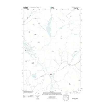
2013 Map of Ragged Lake
USGS Topo · Published 2013About this map
Ragged Lake and the surrounding high country of the northern Adirondacks define this 2013 survey of the Bellmont region. The landscape is heavily marked by the legacy of the timber and charcoal industries, evidenced by settlements like Upper Kilns and Middle Kilns situated along Middle Kiln Brook. Near the northwestern corner, Bryants Mill sits at the edge of Mountain View-Lake, connected by a network of local routes including Bryant Siding Rd and the D and H Rd, indicating the area's historical reliance on both water power and rail access.
Find a feature on this map
59 named features on this map. Tap any name to fly to it.
Don’t see what you’re looking for? This feature index may not catch every label — zoom into the map to look around manually.
Map Details
Editions of this 2013 Ragged Lake Map
This is the sole edition of this map. No revisions or reprints were ever made.
Other maps of this area

1906 · Loon Lake
USGS Topo · 1:62,500

1908 · Loon Lake
USGS Topo · 1:62,500

1911 · Lyon Mountain
USGS Topo · 1:62,500

1913 · Lyon Mountain
USGS Topo · 1:62,500

1915 · Churubusco
USGS Topo · 1:62,500

1915 · Chateaugay
USGS Topo · 1:62,500

1931 · Lyon Mountain
USGS Topo · 1:62,500

1943 · Churubusco
USGS Topo · 1:62,500

1943 · Chateaugay
USGS Topo · 1:62,500

1948 · Ogdensburg
USGS Topo · 1:250,000