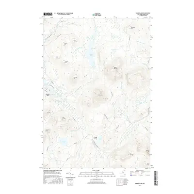
2016 Map of Ragged Lake
USGS Topo · Published 2016About this map
Ragged Lake and its intricate shoreline, including Peavey Bay and The Narrows, dominate this central Franklin County landscape within the Adirondack Park Preserve. The topography is defined by significant elevations such as Ragged Lake Mtn and the Plumadore Range, which overlook a network of glacial ponds and streams. In the western portion, Bryants Mill sits near the headwaters of the Salmon River, marking a point of historic local industry. The southern reach is characterized by the expansive Plumadore Pond and its outlet, while the route of the D & H Rd provides a trace of former transportation corridors through the mountains. This 2016 survey illustrates a terrain of high ridges like Hardwood Hill and Brand Pinnacle, interspersed with remote water bodies like Wolf Pond and Indian Lake, reflecting the persistent wilderness character of the region.
Find a feature on this map
60 named features on this map. Tap any name to fly to it.
Don’t see what you’re looking for? This feature index may not catch every label — zoom into the map to look around manually.
Map Details
Editions of this 2016 Ragged Lake Map
This is the sole edition of this map. No revisions or reprints were ever made.
Other maps of this area

1906 · Loon Lake
USGS Topo · 1:62,500

1908 · Loon Lake
USGS Topo · 1:62,500

1911 · Lyon Mountain
USGS Topo · 1:62,500

1913 · Lyon Mountain
USGS Topo · 1:62,500

1915 · Churubusco
USGS Topo · 1:62,500

1915 · Chateaugay
USGS Topo · 1:62,500

1931 · Lyon Mountain
USGS Topo · 1:62,500

1943 · Churubusco
USGS Topo · 1:62,500

1943 · Chateaugay
USGS Topo · 1:62,500

1948 · Ogdensburg
USGS Topo · 1:250,000