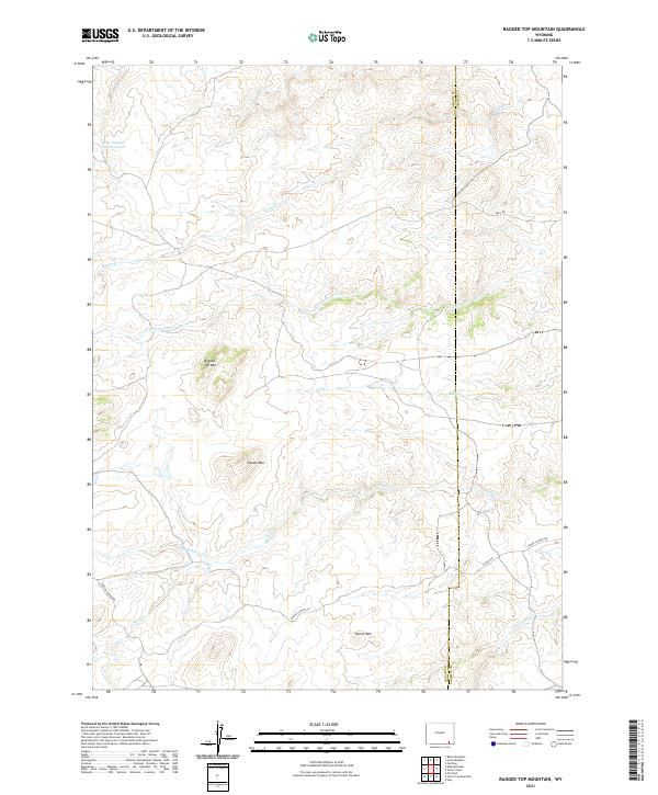
2021 Map of Ragged Top Mountain
USGS Topo · Published 2021About this map
Ragged Top Mountain and the surrounding high-altitude drainage systems of the Laramie Range define this landscape on the border of Albany and Laramie Counties. The map reveals a complex network of seasonal and perennial waters, including Ricker Cr and the N Fork Horse Cr, which carve through the high-elevation terrain. Local water management is evidenced by the Alvie Number One Reservoir in the northwest, serving as a critical resource in this arid environment. Significant landmarks like Powell Mtn and Horse Mtn provide vertical relief and orient the traveler along rural routes such as Roger Canyon Rd. This survey documents the transition from the steep summits to the more gradual slopes associated with Schoolhouse Cr and Mill Cr, illustrating how the physical geography dictates the placement of early ranching roads like Bell Rd and Fisher Canyon Rd.
Find a feature on this map
21 named features on this map. Tap any name to fly to it.
Don’t see what you’re looking for? This feature index may not catch every label — zoom into the map to look around manually.
Map Details
Editions of this 2021 Ragged Top Mountain Map
This is the sole edition of this map. No revisions or reprints were ever made.
Other maps of this area

1905 · Sherman
USGS Topo · 1:125,000

1948 · Ragged Top Mountain
USGS Topo · 1:62,500

1950 · Ragged Top Mountain
USGS Topo · 1:62,500

1954 · Cheyenne
USGS Topo · 1:250,000

1955 · Baldy Mountain
USGS Topo · 1:24,000

1955 · Goat Mountain
USGS Topo · 1:24,000

1958 · Cheyenne
USGS Topo · 1:250,000

1962 · Horse Creek
USGS Topo · 1:24,000

1962 · Farthing
USGS Topo · 1:24,000
1962 · Islay
USGS Topo · 1:24,000