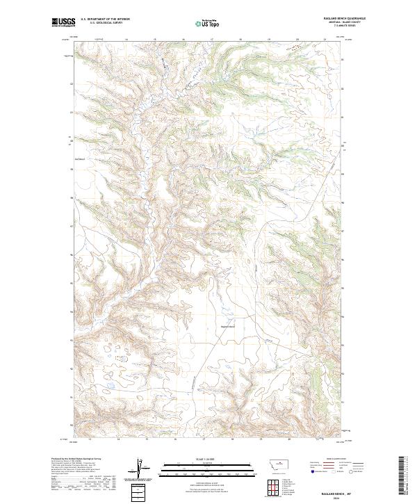
2024 Map of Ragland Bench
USGS Topo · Published 2024About this map
Ragland Bench and the neighboring Golf Bench define this high-plain landscape in Blaine County, characterized by the dramatic drainage patterns of Bills Coulee and Black Coulee. This 2024 survey captures a section of the northern Missouri River watershed where the vast protected lands of the Upper Missouri River Breaks National Monument begin to encroach on the southeastern quadrant. The area is defined by its topographic transition from flat plateau surfaces to the eroded breaks that descend toward the river. Local transport is limited to established routes like Lloyd Rd and Raglan Ridge Rd, which provide access through the sparse ranching terrain and the surrounding sections of the Public Land Survey System, including t24n r18e and t23n r18e.
Find a feature on this map
13 named features on this map. Tap any name to fly to it.
Don’t see what you’re looking for? This feature index may not catch every label — zoom into the map to look around manually.
Map Details
Editions of this 2024 Ragland Bench Map
This is the sole edition of this map. No revisions or reprints were ever made.
Other maps of this area

1954 · Taffy Ridge
USGS Topo · 1:24,000

1954 · Leroy
USGS Topo · 1:24,000

1954 · Gallatin Rapids
USGS Topo · 1:24,000

1954 · Council Island
USGS Topo · 1:24,000

1954 · Lewistown
USGS Topo · 1:250,000

1959 · Lewistown
USGS Topo · 1:250,000

1964 · Ragland Bench
USGS Topo · 1:24,000

1964 · Chase Hill
USGS Topo · 1:24,000
1984 · Eskay NE
USGS Topo · 1:24,000
1985 · Nolan Reservoir
USGS Topo · 1:24,000